Check both axes
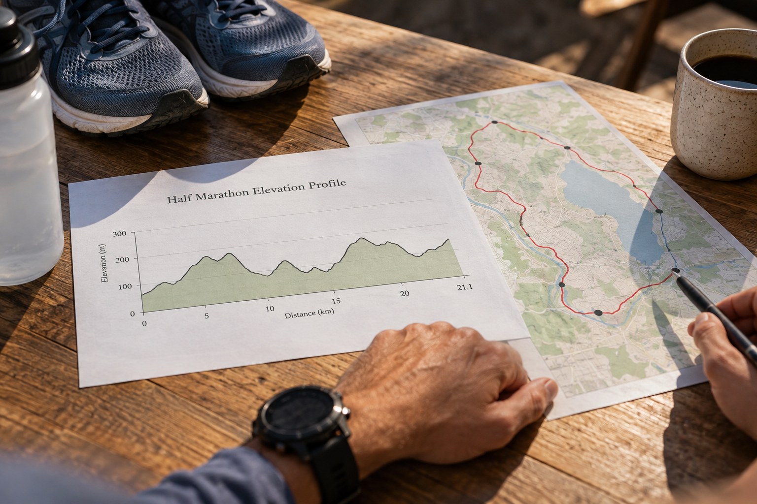
Find the distance scale along the bottom and the height scale at the side. A small vertical change can look dramatic when the height axis is tightly cropped, while a long climb may look gentle on a very wide diagram. Do not compare two race profiles by visual steepness alone unless their scales are comparable.
Look for the units and any note about the source of the elevation data. A profile derived from a recorded track and one drawn from a map can present slightly different detail. Treat small ripples cautiously. The broad position and length of the main climbs usually provide a more useful first reading than attempting to interpret every tiny tooth in the line.
Locate the climbs in the race
Mark where each sustained uphill section begins and ends, then find it on the route map. Ask what surrounds it: a narrow turn, a bridge approach, an aid station or a descent. The same height gain can feel like a different organisational problem depending on where it appears and what comes immediately afterwards.
For a half-marathon, avoid treating the total ascent figure as a complete description. Several short rises spread through the route and one continuous climb can share a similar total. A course that ends below where it starts may still include meaningful uphill work. Net height change and accumulated ascent answer different questions.
Add information the profile leaves out
Surface, width, sharp bends and exposure to weather are not reliably visible on a height graph. Read the route description and current organiser’s notes. A smooth line does not tell you whether the ground is paved, whether a section is crowded or whether an exposed stretch is likely to feel different from a sheltered one on the day.
Use street-level or route photographs carefully where they are available. Check the location and direction rather than attaching an attractive picture to the wrong part of the course. Photographs can help identify a junction or surface, but they do not establish current conditions or the exact gradient. Keep unresolved details as questions instead of filling the gaps with assumptions.
Turn the reading into a few decisions
You do not need a separate pace target for every rise. A simpler plan might identify where to avoid an early surge, where a steady effort matters more than the screen, and where to reassess after a long climb. These are decision points you can remember without watching the profile throughout the event.
If you want to practise on local terrain, choose a feature that resembles the relevant demand rather than trying to reproduce the entire course. A gradual rise and a short steep ramp are different experiences even if both are called hills. Keep that practice within an appropriate training plan rather than adding it as an unplanned test close to race day.
Recheck the profile if the organiser announces a route change. An old screenshot can retain a hill that is no longer included or omit a new section. Store the current map and profile together with their edition or date. That small detail makes your preparation traceable and prevents a polished but outdated diagram from becoming more persuasive than the event’s latest instructions.